Arbel Synagogue
site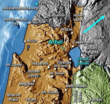
This synagogue was possibly constructed in the fourth century AD and was refurbished in the sixth century A.D. It may have been destroyed in the great earthquake of 749 A.D. It faces south, towards Jerusalem.
The village of Arbel, in which it was situated, is located about 1.3 mi. [2 km.] west southwest of the Arbel Cliffs. The village was known for its manufacture of linen garments — "the rough linen garments from Arbela" (Genesis Rabba 19:1).
For additional information see Zvi Ilan, Avraham Isdarechet. "Arbel." Pages 87-89 in The New Encyclopedia of Archaeological Excavations in the Holy Land — vol. 1. Edited by Ephraim Stern, Ayellet Lewinson–Gilboa and Joseph Aviram. Jerusalem: Israel Exploration Society and Carta, 1993.
Photos (10)


Keywords: Synagogue, Arbel, Zvi Ilan, Avraham Isdarechet, Diagram, Carta, Sea of Galilee, North, Israel